
The photographs below are aerial views of the new shared use cycle and pedestrian path constructed as part of the Dunkettle Interchange Upgrade Advance Works, and opened to the public on 16th November 2020.
The section of footway/cycleway that is currently opened is shown on the map graphic below – Point A to Point B and Point C to Point D. The graphic also illustrates how this section will tie in with Cork City Council’s plans for cycleways in the Glanmire area and with Cork County Council’s plans for cycleways along the old N25 eastward from Glanmire, as well as a further section of cycleway to be constructed as part of the Dunkettle Project which will complete the cycleway link from Tivoli to Little Island.
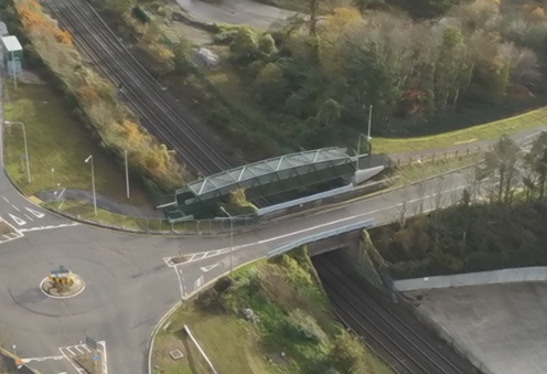
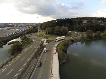
On the left below is a view southward from the Gaelscoil on Richmond Road to the new Roundabout, with raised segregated cycleway/footpath visible on the left. This route continues to Bury’s bridge and to the planned Glounthaune – Carrigtohill greenway to the east. On the right below is an aerial view from the west of the new cycle/pedestrian bridge over the Cork-Midleton railway line at Bury’s Bridge. The bridge is now open to the public. As part of the main Dunkettle upgrade works, the cycle route which currently merges with the road south of the bridge will be continued south as a segregated cycle/pedestrian route, crossing over the N25 and linking to the R623 Regional Road.
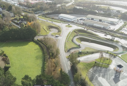
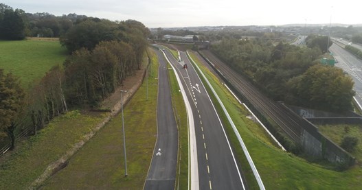
On the left below is an aerial view of the Dunkettle (Glashaboy) Roundabout taken from the east, with widened segregated cycleway in the foreground, and toucan crossings at the newly signalised Roundabout in the background. To the right is an aerial view of new Cycleway linking the N8 and R639 (Glanmire Road to the Richmond Road).
For more on how the Dunkettle Interchange Upgrade will facilitate active and sustainable modes of transport in the region, see Sustainable Transport.
For more detail on the new bridge over the Cork-Midleton railway line, see Structures.